The Hidden Chemistry: Weathering, Mobility & Pathfinder Elements
The deposit that hides its own commodity
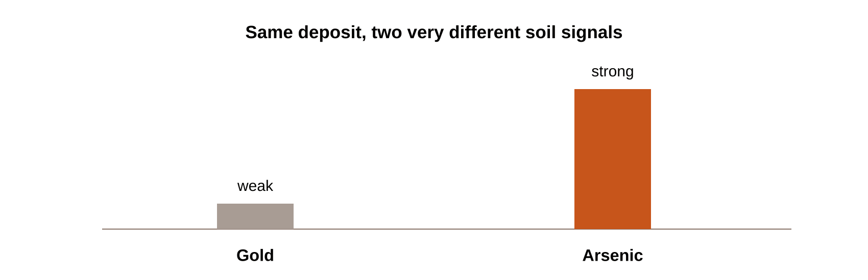
Here’s a scenario that surprises people outside exploration geology: soil directly above a real gold deposit can show a weak, barely-detectable gold anomaly — while arsenic, sitting in the
same soil, shows a strong and unmistakable one. The gold is genuinely there. It’s just chemically stubborn about showing itself.
Understanding why requires stepping back to the underlying chemistry — weathering, mobility, and the pathfinder elements that do the work gold and other target metals can’t do for
themselves. This is the chemistry underneath every soil program we run, from our gold clusters at Jomu, Kahama, and Geita to the graphitic ground of Tanga and Lindi.
From bedrock signature to soil anomaly
A mineral deposit starts as a concentration of elements locked inside bedrock — a gold deposit, for instance, often carrying gold alongside arsenic, antimony, and bismuth. Weathering is what
turns that buried signature into something detectable at surface.
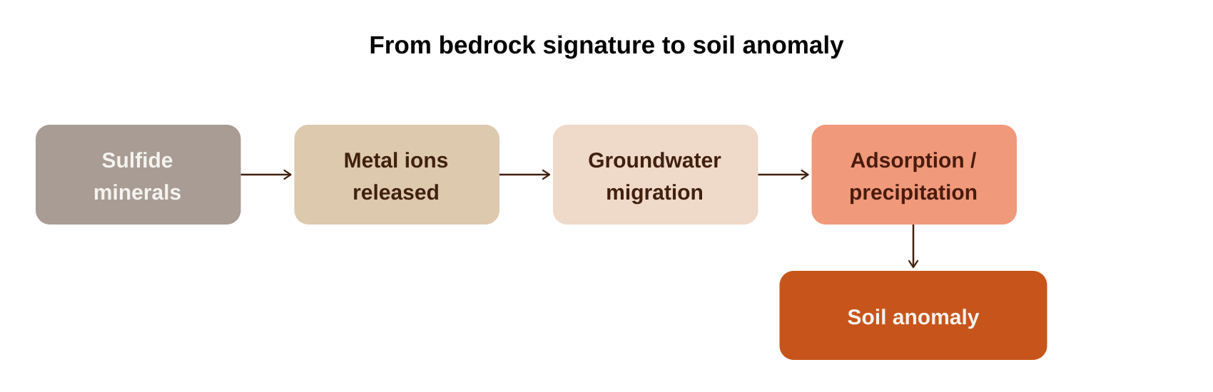
Physical weathering fragments the rock and increases surface area. Chemical weathering — oxidation, hydrolysis, dissolution — breaks sulfide minerals down and releases metal ions, which
then migrate through groundwater before being adsorbed or precipitated into soil.
Residual soil vs. transported soil
Whether that transformed signal still sits above its source depends on one more variable: has the soil moved?
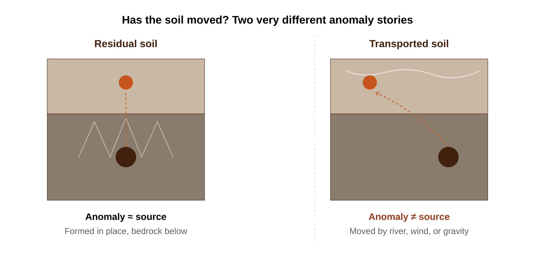
Residual soil forms directly from the bedrock beneath it and stays approximately above its source — granite weathers into residual soil in place. This gives a strong bedrock-soil relationship
and much cleaner anomaly interpretation: in residual terrain, anomaly location approximates source location.
Transported soil has been moved — by rivers, wind, glaciers, or gravity — and may bear no relationship to the geology underneath it. In transported terrain, anomaly location does not equal
source location, and failing to recognize this is one of the biggest causes of drilling barren targets in exploration generally.
When weathering runs deep: the tropical case
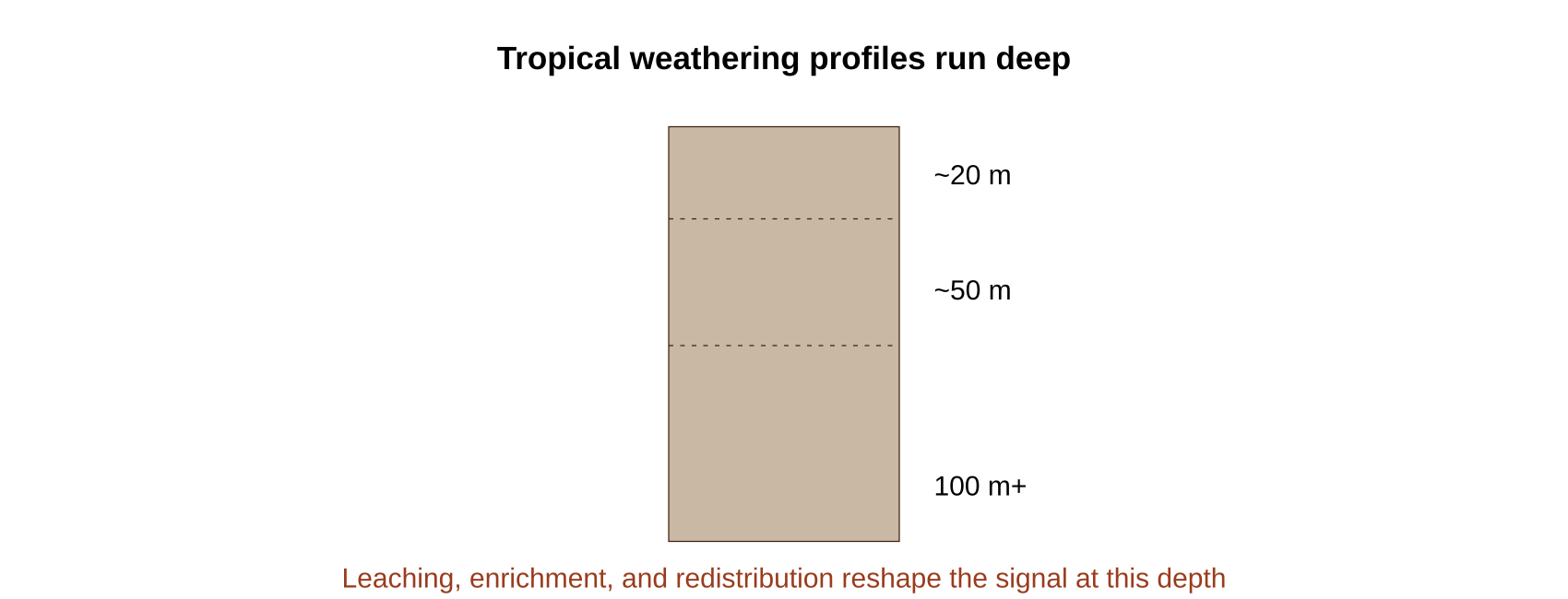
In tropical regions — including much of Tanzania — weathering profiles can exceed 20 m, sometimes 50 m, occasionally more than 100 m. Prolonged weathering at that scale does more than
release elements; it actively reshapes the signature through leaching (removing some elements), enrichment (concentrating others), and redistribution (moving elements both vertically and
laterally)
The consequence: a secondary enrichment zone can form that no longer directly represents the original ore body’s geometry. The peak anomaly can be displaced, some metals enriched while
others are depleted, and the original ore shape obscured under the weathering profile. This is a well-documented consideration across India, Brazil, Australia, and Africa alike — deep tropical
weathering is the rule in these settings, not the exception.
This is a live consideration across our own ground — deep weathering profiles are part of what makes careful, horizon-consistent orientation work (see Post 2) essential before
interpreting any anomaly on our Tanzania licenses.
Download the Investor Deck →
Why some elements are better pathfinders than others
A good pathfinder element needs to do two things: be genuinely associated with the mineralization, and be more mobile than the target metal itself.
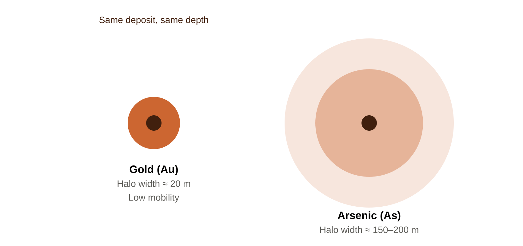
Gold is famously immobile — chemically inert and poorly soluble, meaning it tends to stay close to where it was released. Arsenic, associated with the same gold deposits, is considerably more
mobile and produces much larger dispersion halos as a result. In a documented comparison, a gold anomaly might measure 20 m wide while the associated arsenic anomaly stretches to 150
200 m — arsenic is simply easier to detect, even though gold is the actual target commodity
Poor pathfinders, by contrast, aren’t genetically tied to the deposit, or they’re too erratic, too mobile, or too immobile to produce a usable signal. This is exactly why early-stage exploration
programs so often lead with pathfinder geochemistry rather than assaying for the commodity directly — the pathfinder finds the system before the target metal becomes detectable at all.
Fe-Mn oxides: the scavengers doing the concentrating
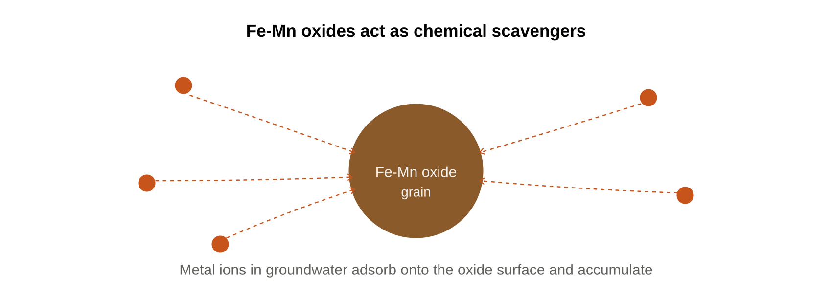
Iron and manganese oxides — goethite, hematite, ferrihydrite, pyrolusite — are among the most powerful geochemical scavengers found in soil. Their high surface area and strong affinity for
metal ions let them adsorb copper, lead, zinc, cobalt, nickel, arsenic, and uranium as groundwater carries these metals past them.
pH, redox, and why the same deposit can look different in different soils
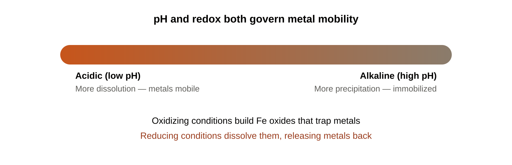
Metal mobility is strongly governed by soil chemistry, not just the metal itself. Under acidic (low pH) conditions, more dissolution occurs and metals like copper, zinc, cadmium, and lead
become more mobile. Under alkaline (high pH) conditions, more precipitation occurs and those same metals become comparatively immobilized.
Redox conditions add another layer: oxidizing conditions convert Fe²
⁺
to Fe³
⁺
, forming the iron oxides that adsorb metals as described above. Reducing conditions can dissolve those same
oxides, releasing previously trapped metals back into solution. The practical implication is real: the same deposit can produce meaningfully different soil anomalies depending on the pH-redox
environment it sits under, which is one more reason a single sampling pass in unfamiliar terrain deserves caution before conclusions are drawn.
This kind of chemistry-first interpretation — understanding why an anomaly looks the way it does, not just that it exists — is central to the due diligence and exploration work
Sakariya Geo Services carries out across commodities.
When the strongest anomaly sits beside the deposit, not above it
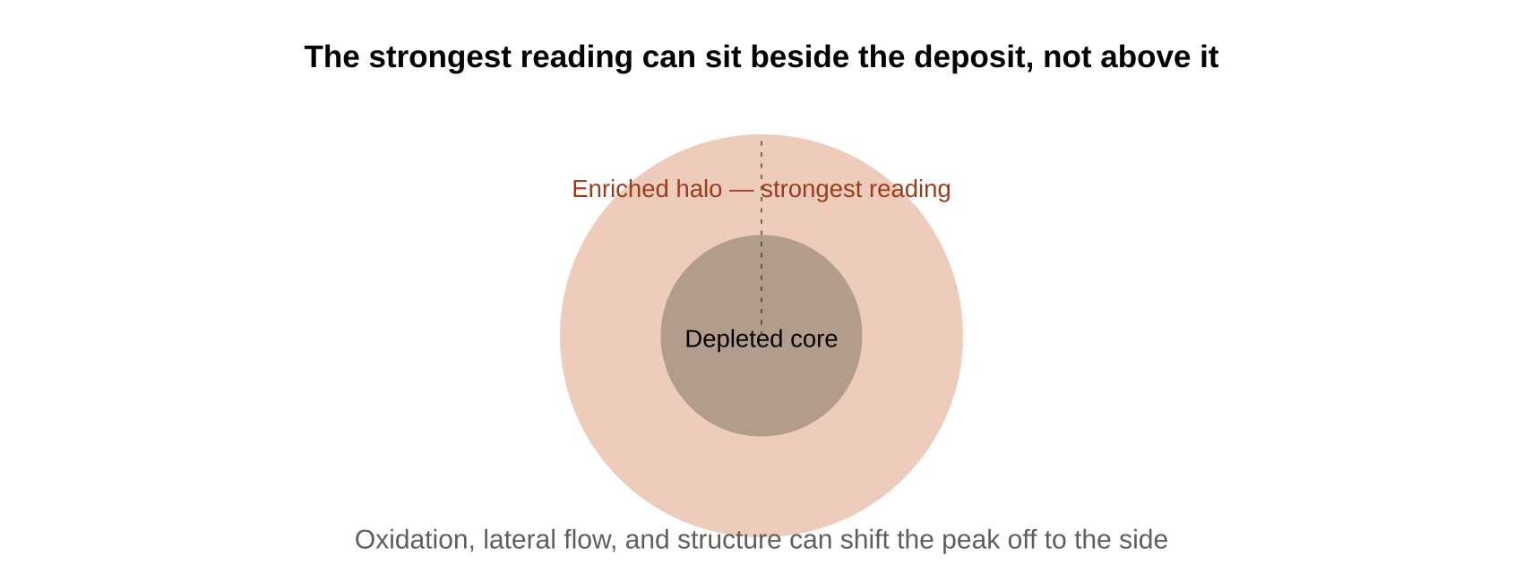
One more counterintuitive pattern worth knowing: the strongest soil anomaly can occur adjacent to a deposit rather than directly on top of it. A few mechanisms explain this. Oxidation directly
above sulfides can leach metals away from that exact spot. Lateral groundwater movement can carry metals sideways before they precipitate. Structural fractures beside the deposit can
become preferred fluid pathways. And many deposits produce a genuine halo structure — a metal-depleted core zone surrounded by a metal-enriched halo zone — meaning the strongest
reading legitimately sits off to the side.
Related to this, on sloped terrain, gravity-driven soil creep, surface runoff, and colluvial transport can all displace an anomaly downslope from its actual source. Deposit location and anomaly
peak are not guaranteed to be the same point, and understanding local geomorphology becomes part of reading the anomaly correctly.