Which Horizon? Getting Sample Depth Right in the Field
The question that gets asked too late
Ask most field crews why they’re sampling the B horizon and you’ll often get the same answer: “that’s what we always do.” It’s a reasonable default — but it’s a default, not a rule.
And on a new project, in unfamiliar terrain, that default can be exactly the decision that costs you the anomaly.
This is the kind of question we ask on every new prospecting license before a single sample bag gets filled — whether we’re testing ground in the Kahama or Geita gold clusters or
walking graphitic horizons across Tanga and Lindi.
Why the B horizon gets sampled by default
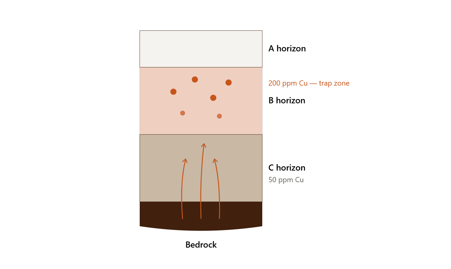
The B horizon is commonly favored not because it’s closest to the source rock — it isn’t — but because the goal of most surveys is anomaly detection, not direct bedrock measurement.
The B horizon typically contains clay minerals, iron oxides, and manganese oxides — materials that adsorb and concentrate metals migrating up from depth. The logic chain:
When the C horizon wins instead
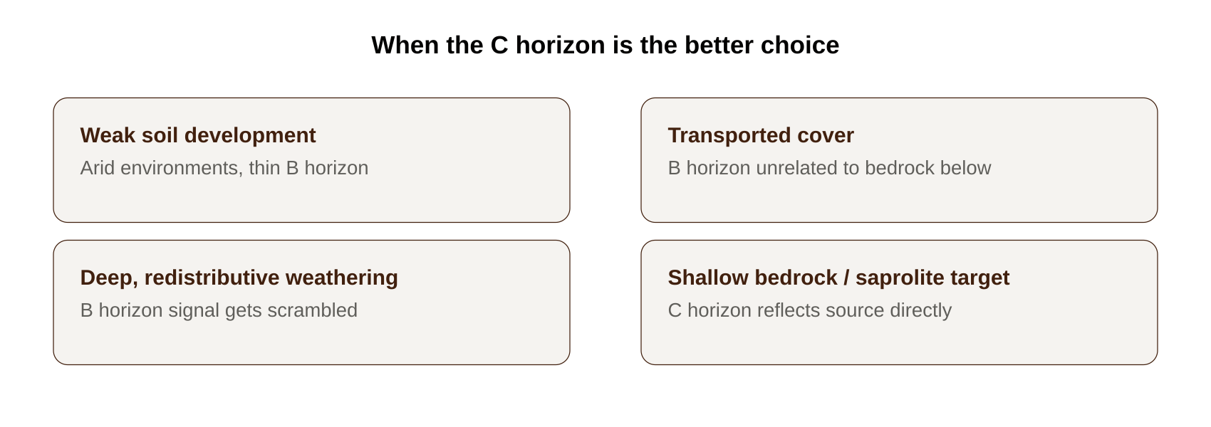
The B horizon default breaks down under specific geological conditions. The C horizon is often the better choice when:
In these situations, geological representativeness matters more than geochemical enrichment. A stronger-looking anomaly in the wrong horizon is worse than a weaker one in the
right horizon.
We’ve seen this play out directly across our Tanzania portfolio — terrain and weathering profiles differ enough between our gold clusters and our graphite ground in Tanga and Lindi that horizon selection is never assumed, it’s tested.
Download the Investor Deck →
Finding the right horizon on unexplored ground: the orientation survey
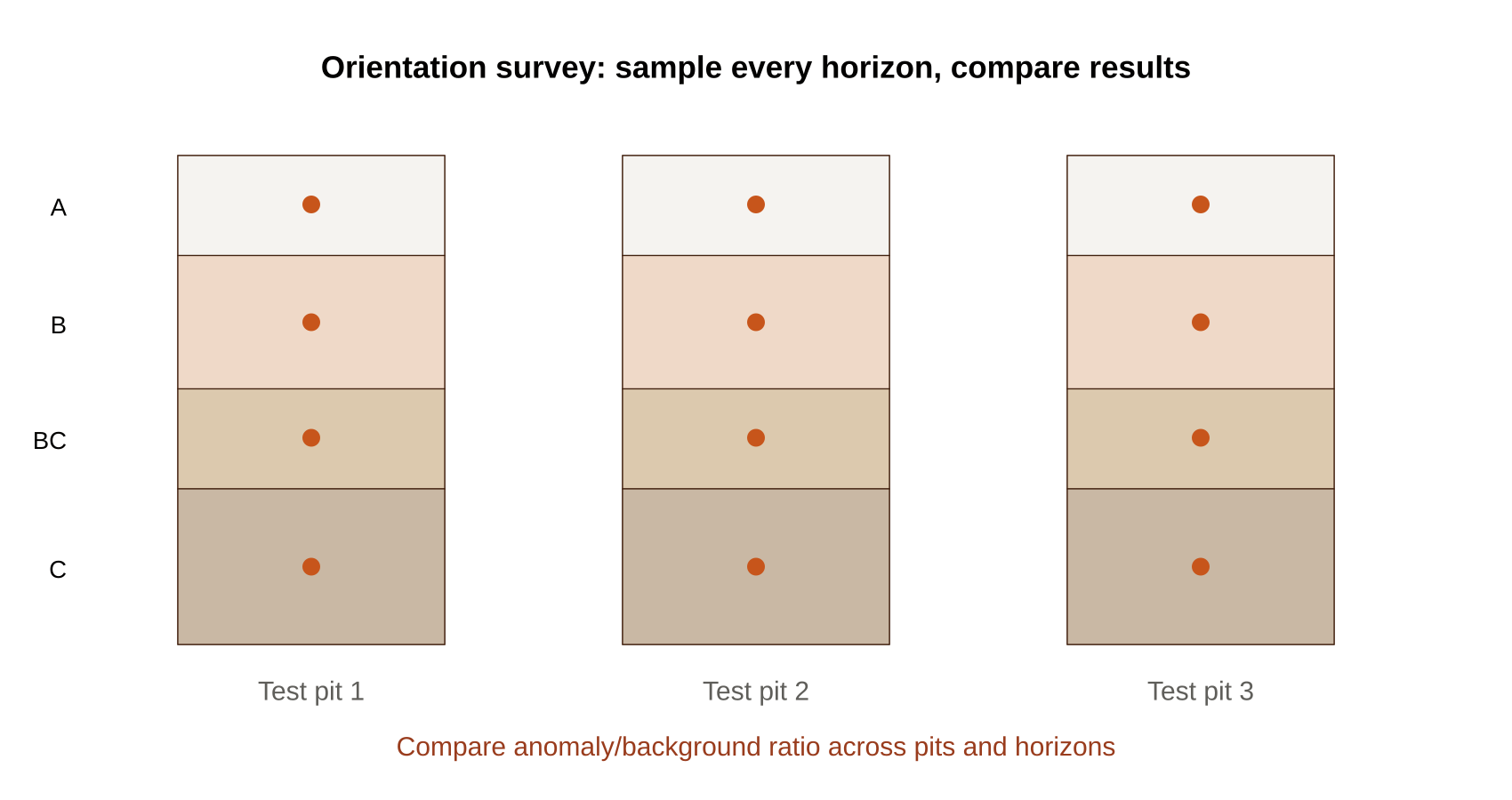
On a genuinely new project, you don’t guess the horizon — you test for it. The standard procedure:
The best horizon is the one with the highest anomaly-to-background ratio, the lowest noise, and the best consistency — not automatically the B horizon. This orientation work
happens before a detailed survey design is locked in, because getting it wrong at this stage means every sample collected afterward inherits the mistake.
Why mixing horizons inside one survey quietly ruins the data
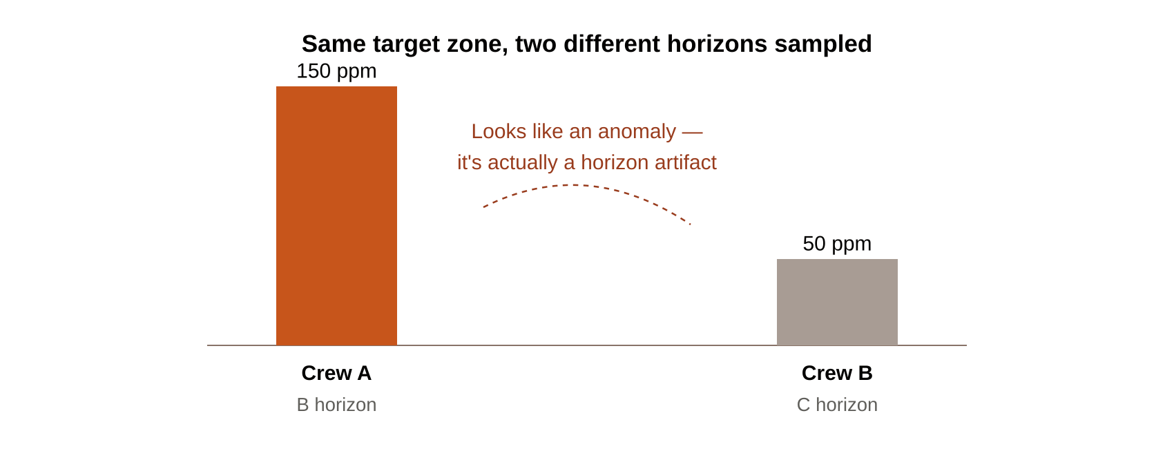
Here’s a mistake that doesn’t announce itself. Suppose two crews sample the same target zone, but one collects from the B horizon and one from the C horizon:
Read at face value, Sample A looks like a strong anomaly next to Sample B. But that 100 ppm difference may have nothing to do with geology — it may be entirely a function of
which horizon each crew happened to sample. The variation reflects sampling inconsistency, not the ground.
A mixed-horizon dataset can manufacture anomalies that don’t exist and mask ones that do — and because the numbers still look internally consistent, this kind of error is easy to
miss until someone drills a target that turns out to be a horizon artifact rather than mineralization.
The fix is procedural, not clever: pick a horizon during orientation, document it, and hold every crew to it for the life of the survey.
What you lose by sampling only one horizon
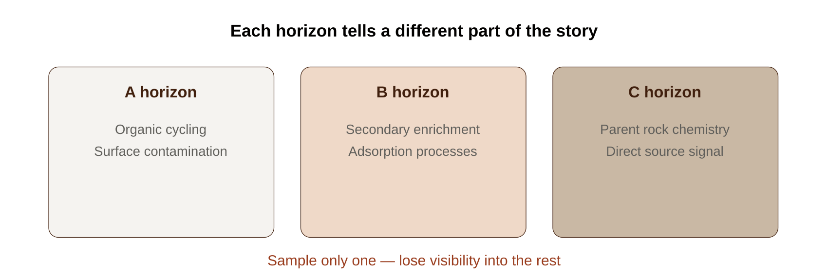
Even with a consistent, correctly-chosen horizon, sampling only one layer means giving up information the others would have shown you:
Sample only one, and you may lose visibility into vertical metal migration, weathering intensity, secondary enrichment, lithological control, and transport processes — all things a
multi-horizon orientation study can reveal that a single-horizon production survey never will.
This is precisely the kind of layered, multi-horizon assessment
Sakariya Geo Services brings to due diligence work — understanding not just what a soil result says, but what horizon it came from and what that choice means for interpretation.
Consistency beats depth
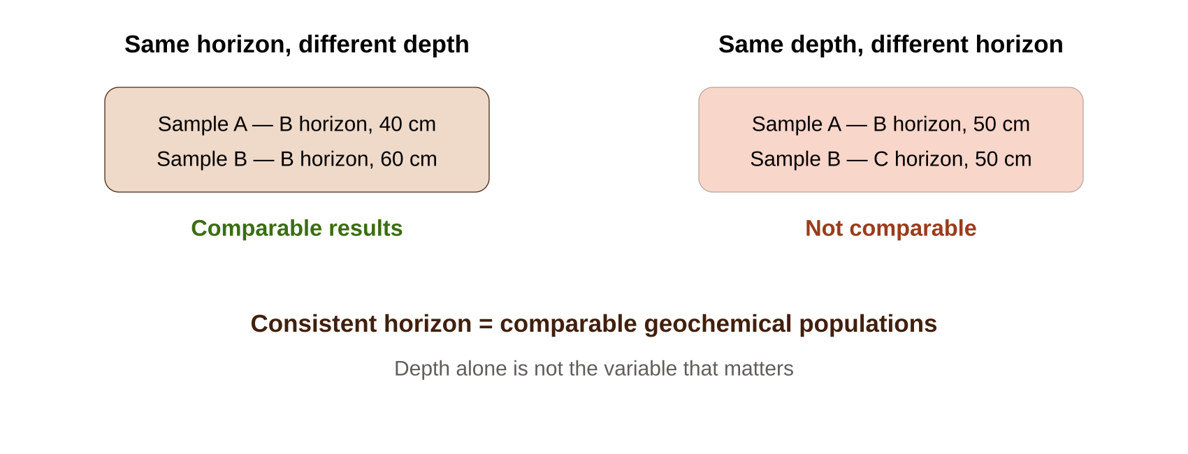
One more distinction worth internalizing: two samples at the same depth but different horizons are not comparable, while two samples at different depths within the same horizon
usually are.
A sample at 40 cm in the B horizon and one at 60 cm in the B horizon are often reasonably comparable. A sample at 50 cm in the B horizon and one at 50 cm in the C horizon —
identical depth — sit in completely different geochemical environments, with different clay content, Fe-Mn oxide content, organic matter, and metal retention capacity.
Consistent horizon = comparable geochemical populations. Depth alone is not the variable that matters
Building the dataset that holds up
Getting horizon selection right isn’t a technicality — it’s the foundation every anomaly interpretation downstream depends on. It’s also exactly the kind of rigor we apply across our
active Tanzania programs, from the Jomu, Kahama, and Geita gold targets to the Tanga and Lindi graphite clusters where resource estimation work is now underway