Commodities

We are building beyond gold and graphite, strengthening our exploration capabilities and preparing for a future rooted in responsible mining and resource innovation.

Sakariya Mines and Minerals – Tanzania Operations

The geological environment of the Mozambique Belt offers highly favorable conditions for the formation and concentration of graphite deposits. With its proven potential, the belt continues to attract exploration interest, positioning our license areas strategically within a prominent graphite-bearing zone.

Graphite Projects

Exploration Programs – Tanga and Lindi Clusters

Exploration commenced in the Lindi Cluster in June 2022 and the Tanga Cluster in August 2022, with Sakariya Mines and Minerals deploying its in-house team of geologists to conduct systematic field studies and geological mapping programs across the prospecting licenses.

All our 7 graphite exploration projects are located in well-established graphite bearing zones of Mozambique Belt; neighboring EPANKO (Ecograf), LINDI-JUMBO (Lindi Jumbo Ltd.), BUNYU (Volt Resources Ltd.) graphite deposits.

Tanga Cluster

Tanga_map

The exploration program began with reconnaissance mapping at a 1:20,000 scale, followed by detailed geological mapping at a 1:5,000 scale. During this stage, grab samples were collected for preliminary graphite analysis. Since the exposures were discontinuous, shallow pits were excavated on systematic grids to obtain subsurface information and define the boundaries of the graphitic schist more confidently. Channel samples were also taken from suitable exposures.

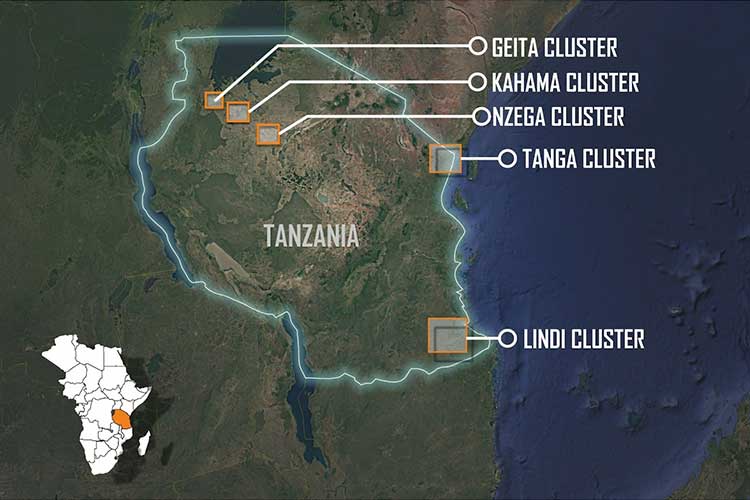
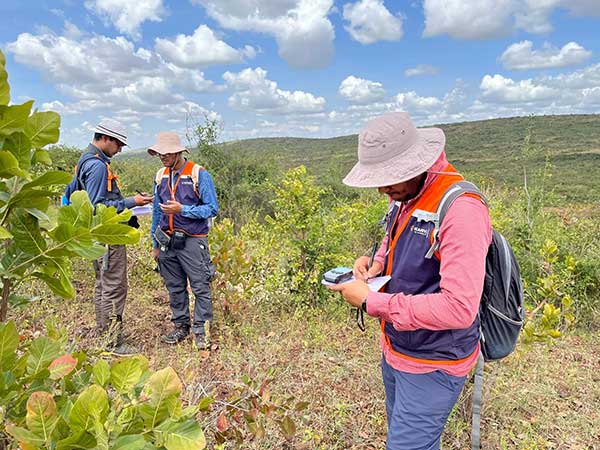
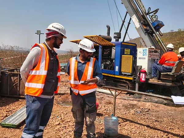
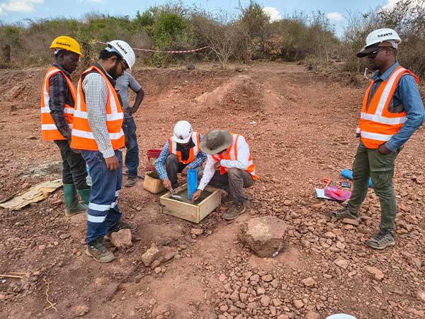
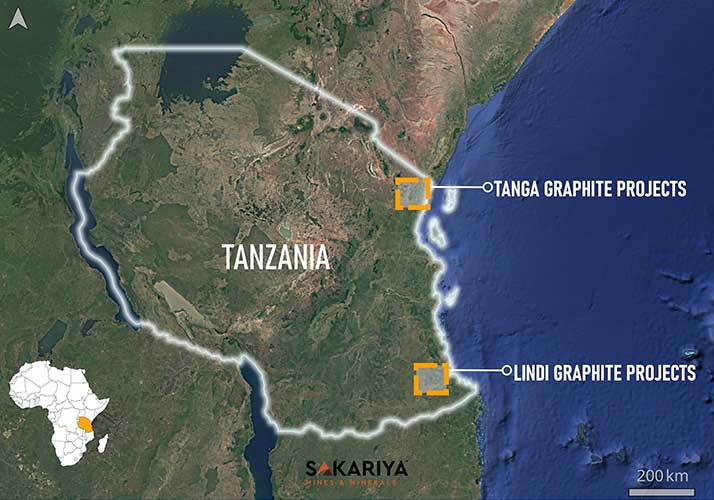
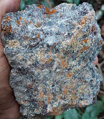
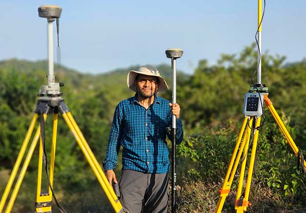
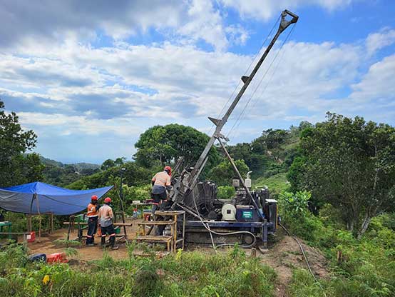
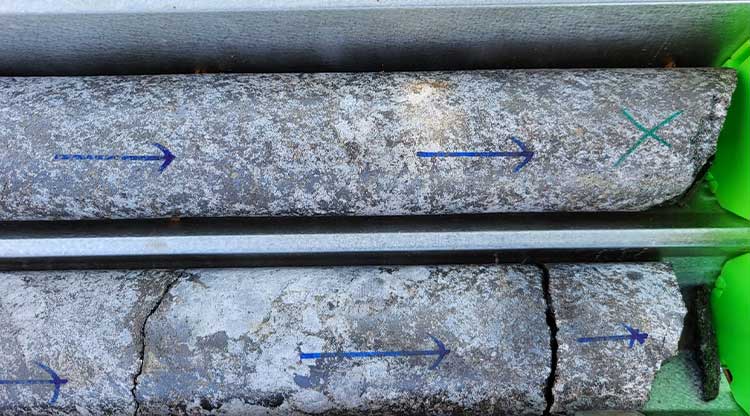
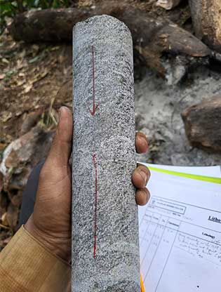
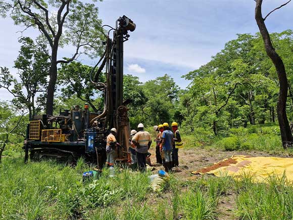
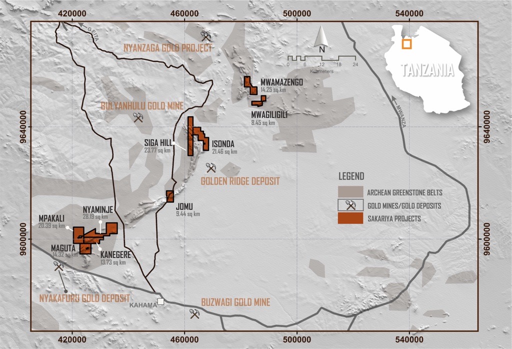
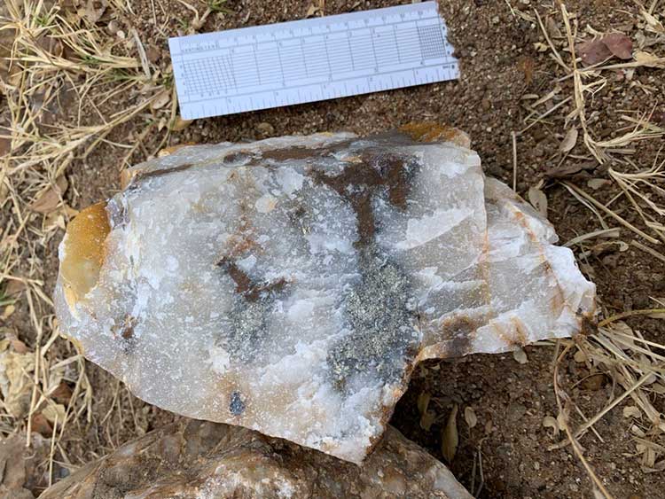
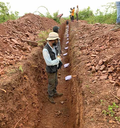
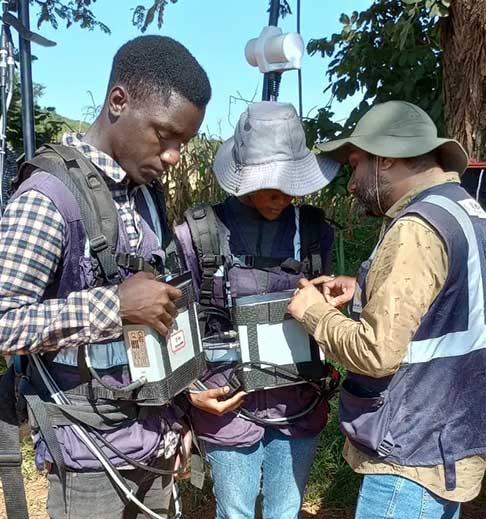
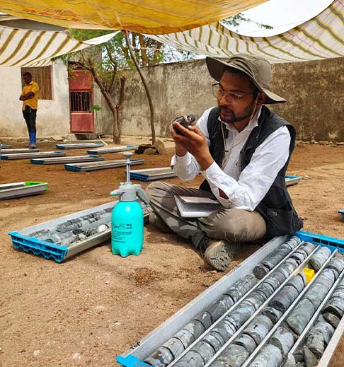
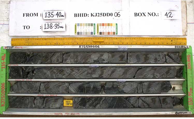
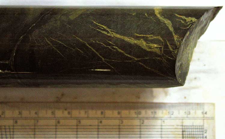
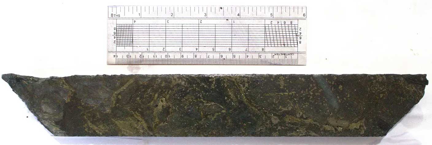
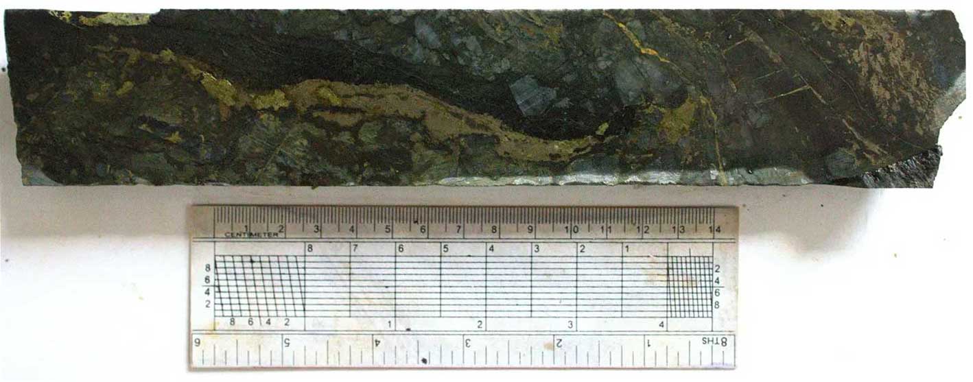
Results confirmed the presence of graphite with jumbo to super-jumbo flake sizes and high-grade mineralization, highlighting the strong potential of the deposits. Subsequently, diamond drilling commenced in April 2024 within the Tanga Cluster, during which 100 boreholes totaling 9,634.80 meters of drilling were completed. This phase provided vital subsurface information on the thickness, continuity, and grade of the graphitic zones. Results consistently confirmed the presence of high-grade graphite mineralization with jumbo to super-jumbo flake sizes, along with strong continuity of graphitic zones, further strengthening the deposit’s potential. A detailed drone-based LiDAR survey, supported by ground DGPS, was undertaken to generate high-resolution topographic models and precise borehole positioning.

Exploration Activities in Tanga

0 Sq. Kms
Geological Mapping
0 Sq. kms
Topographic Survey
0 Nos.
Grab Samples
0 Nos.
Pit Samples
0 Nos.
Channel Samples
0 Nos.
Borehole Samples
0 Nos.
Total no. of Pits
0 Boreholes
Total no. of Boreholes
0 Meters
Total Meters Drilled

Hand Specimen Sample of Graphite

Topographic Survey

Drilling activities in the Tanga projects

Drill Core Sample of Graphite

Drill Core Sample of Graphite

Lindi Cluster

Lindi_map

In the Lindi Cluster, reconnaissance mapping was carried out with surface exposures of graphitic schist observed only in limited areas. To evaluate the potential, auger and rotary air blast (RAB) drilling programs were implemented on a systematic grid. A total of 33 auger holes and 406 RAB boreholes were drilled, generating samples that were submitted to SGS Mwanza for laboratory analysis. The assay results proved highly encouraging, indicating significant graphite potential and supporting the recommendation for diamond drilling as the next phase of exploration.

In addition, limited pitting and trenching provided further geological insights in areas with restricted surface exposure, confirming the presence of graphitic units. The results from these programs are expected to provide a clearer understanding of subsurface geology and help guide the forward exploration strategy.

Exploration Activities in Lindi

0 Sq. Kms
Geological Mapping
0 Nos.
Grab Samples
0 Nos.
Trench Samples
0 Boreholes
Total no. of BHs (RAB + Auger)
0 Nos.
Borehole Samples
0 Meters
Total Meters Drilled

RAB drill at Lindi Graphite Concession

Gold Projects

Sakariya Mines and Minerals operates 21 gold exploration projects with a cumulative area of 459.5 sq. km area in Tanzania. These highly prospective projects are located in the gold endowed Lake Victoria Goldfield (LVG) region of Tanzania which has a long history of gold production since 1909. Till date, more than 80 million ounces gold have been produced from LVG.

Our projects are strategically distributed in multiple gold enriched greenstone belts of LVG: inner Sukumaland Greenstone Belt, outer Sukumaland Greenstone Belt and Nzega Greenstone Belt. Each of these belts host world class gold deposits like Geita, Bulyanhulu and Golden Pride. By conducting systematic exploration, we have identified promising targets which holds the potential of becoming major deposits in near future. Sakariya’s vision is to become a trusted name in gold production, with our strong dedication towards sustainability, innovation and environment.

Kahama Cluster

We have nine assets in Kahama Cluster with a cumulative area of 131.3 sq km, and all the projects are located in the outer arc of Sukumaland Greenstone Belt.

Hand Specimen Sample of Sulphide

  • Extensive exploration in 5 projects
  • 18 Exploration targets in 4 projects
  • Diamond drilling planned in 3 projects
  • 11 km cumulative strike length of the targets in 3 projects
  • 13000+ m diamond drilling plan to test the targets

Licenses included

SIGA HILL PROJECT (23.77 sq km)

The Siga Hill Project is one of our most promising projects located approximately 20 km east of Bulyanhulu Gold Mine. We have identified seven exploration targets through geological, geochemical, geophysical and trench data.

0 stations
Ground magnetic data acquisition
0 line km
Induced Potential (IP) data acquisition
0 meter
Trenching completed on mineralized zone
0 +
Soil samples analyzed to detect anomalous zones
0 +meter
Diamond drilling plan
0 stations
Ground magnetic data acquisition
0 line km
Induced Potential (IP) data acquisition
0 +
Soil samples analyzed to detect anomalous zones
0 +meter
Diamond drilling plan
ISONDA PROJECT (21.46 sq km)

The Isonda Project shares its western boundary, as well as its geology, with the Siga Hill Project. We have verified the continuation of potential structures of Siga Hill into the Isonda Project area through geological, geophysical and geochemical survey data. Six exploration targets were identified
in this project.

JOMU PROJECT (9.44 sq km)

Jomu is our flagship project located approximately 40 km north of Kahama town. We have identified three exploration targets, with a cumulative strike length of ~2.5 km, in this project.

0 line km
Ground magnetic data acquisition
0 line km
Induced Potential (IP) data acquisition
0 +
Soil samples analyzed to detect anomalous zones
0 +meter
Diamond drilling plan
0 line km
Ground magnetic data acquisition
0 stations
Ground magnetic data acquisition in Maguta
0 +
Soil samples analyzed to detect anomalous zones
0 +meter
Diamond drilling plan
MAGUTA (14.32 sq km), KANEGERE (13.73 sq km), Mpakali (20.39 sq km) and Nyaminje (28.19 sq km) PROJECTS

These four projects are located approximately 35 northwest of Kahama town. We have identified gold potential of these projects through geological, geochemical and geophysical data. Two promising targets were identified in Maguta and Kanegere projects. We are actively conducting exploration programs in these projects.

Trench Sampling

Ground Magnetic Survey Team

Geologist examining drilled core

Drilled core from Jomu project

Drill core specimen

Nzega Cluster

We have eight assets in Nzega Cluster with a cumulative area of 225.11 sq km. These projects are located in various parts of the Nzega Greenstone Belt. We have identified four highly potential targets with a cumulative strike length of 10.4 km

  • Extensive exploration in 3 projects
  • 1600+ line-km planning for drone magnetic survey in 2 projects
  • Total 4 exploration targets identified in 3 projects
  • 10.4 km cumulative strike length of the targets in 3 projects

Licenses included

MWABULA PROJECT (11.61 sq km)

The Mwabula Project is located approximately 30 km east of Nzega Town and falls on the SE extension of the Golden Pride Shear Zone which got its name from the world class Golden Pride deposit. We have identified two exploration targets in Mwabula with ~2.5 km cumulative strike length.

0 line km
Ground magnetic data acquisition
0 +
Soil samples analyzed to detect anomalous zones
0 line km
Ground magnetic data acquisition
0 +
Soil samples analyzed to detect anomalous zones
CHOMA PROJECT (17.93 sq km)

The Choma Project is one of our potential assets in Nzega Cluster, and it is located ~30 km northeast of Nzega Town. We have identified an exploration target of ~2 km in this project.

NHOBOLA (44.38 sq km) AND MALILITA (21.29 sq km) PROJECTS

We have acquired these two new prospects. The Golden Pride Shear Zone passes through these projects with 10+ km cumulative strike length.

0 sq. kms
Ground magnetic data acquisition
0 +
Soil samples analyzed to detect anomalous zones

Setting up Magnetometer for survey

Ground Magnetic Survey

Geita Cluster

We have four assets in Geita Cluster with a cumulative area of 55.28 sq km. These projects are distributed in the outer and inner arcs of the Sukumaland Greenstone Belt.

  • High resolution drone magnetic survey in all 4 projects
  • Drone based magnetic data acquisition along 1396 line-km
  • Potential structures identified in 3 projects (Iparamasa, Katoro I and Katoro II)
  • NE-SW trending shear zones identified. Similar structures host gold in nearby Buckreef Mine

Licenses included

IPARAMASA (37.41 sq km), KATORO I (8.3 sq km) AND KATORO II (2.74 sq km) PROJECTS

These three projects share boundaries and are located ~5km west of Buckreef Gold Mine. We have identified potential structures in these projects from interpretation of geophysical data. We are conducting active exploration programs to further pinpoint the targets.

0 line km
Drones based magnetic data acquisition
0 +
Soil samples analyzed to detect anomalous zones
Geologist doing Geological Mapping